Specs Fine Books
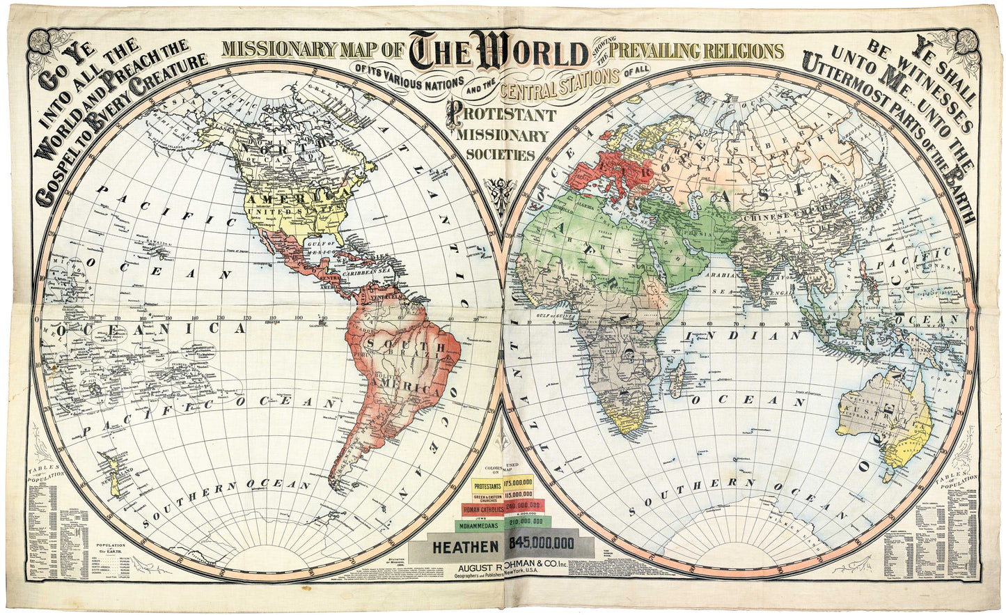
1906 MISSIONARY MAP. Extraordinary 44 x 80 Inch Linen Printed Missionary Map for Exhibitions. Rare Pristine Survivor.
1906 MISSIONARY MAP. Extraordinary 44 x 80 Inch Linen Printed Missionary Map for Exhibitions. Rare Pristine Survivor.
Couldn't load pickup availability
An extraordinary and impressive version of one of the most visually immersive artifacts of the missionary revival of the 19th and early 20th centuries.
The present map, measuring 44 x 80 inches, was executed by August R. Ohman is the fourth variant state of the George W. & Charles B. Colton Missionary Map of the World.
The first state was produced by Joseph Hutchins Colton, c.1846, but it seems the plates were destroyed. In response to continued demand from missionary societies and religious educators his sons Charles and George set out to produce a new, updated map in 1878. To that end they combed through reports of dozens of major and minor missionary societies, both American and foreign, with the result being “the most complete map of the kind ever made, both in appearance and in the extent and accuracy of its information.”
These large format maps, according to an article in the Missionary Herald were intended “for monthly concerts, Sabbath schools, lectures on missions, and even for the instruction of common schools in geography, it will be found an important auxiliary.” (Missionary Herald, Volume XLI No. 12, i.e. December of 1845, p. 418). Hence the map’s great size made it well-suited for display before large groups. And the use of linen rendered it both durable and portable. A September 1846 report of the American Board of Commissioners for Foreign Missions testifies to the usefulness of the format:
“The extensive use of these maps in lectures on missions and at the monthly concert of prayer, is doing much to diffuse definite information as to the condition and wants of the unevangelized world and the progress of evangelical missions, and to promote effort and prayer for the universal promulgation of the gospel.” (p. 83)
In addition to the J.H. Colton map of 1846 and the G.W. and C.B. Colton map of 1878 offered here, in 1892 the Coltons published another mammoth map, being the Missionary Map of the World showing the Prevailing Religions of its Various Nations and the Central Stations of the Protestant Missionary Societies. The Colton firm sold to August R. Ohman in 1893, after which he issued the present state in or around 1906, likely to coincide with the many missionary exhibitions being held across America in that year and to provide updated missionary information, the number of missionaries on the field being significantly increased in 1906 from what it had been in 1878.
The banner’s great size, color scheme, decorative lettering, and foliate ornamentation all combine to render this a most impressive and attractive production.
All versions appear to be extremely rare. OCLC describes only the two Ohman editions, each with a single institutional holding, while the Library of Congress holds the 1878 map. Of all the editions, we note only three examples having appeared on the antiquarian market: examples of the 1892 map sold in 2001 by Old World Auctions and in early 2017 by Altea Gallery, and an example of the ca. 1906 Ohman map sold by Altea in 2016.
Our edition also rather extraordinarily well preserved. It appears to have been in storage almost since its original use and remains bright, clear, and crisp with a very stable linen substrate.
An extraordinary display item from the height of the late 19th and early 20th’ century missionary awakening.
Share


