Specs Fine Books
1884 EGYPT, SUDAN, &c. Superb Victorian Map of the Nile Region - North Africa & Middle East.
1884 EGYPT, SUDAN, &c. Superb Victorian Map of the Nile Region - North Africa & Middle East.
Couldn't load pickup availability
A very fine colonial view map of Northern Africa the Middle East issued in 1884 by Edward Stanford.
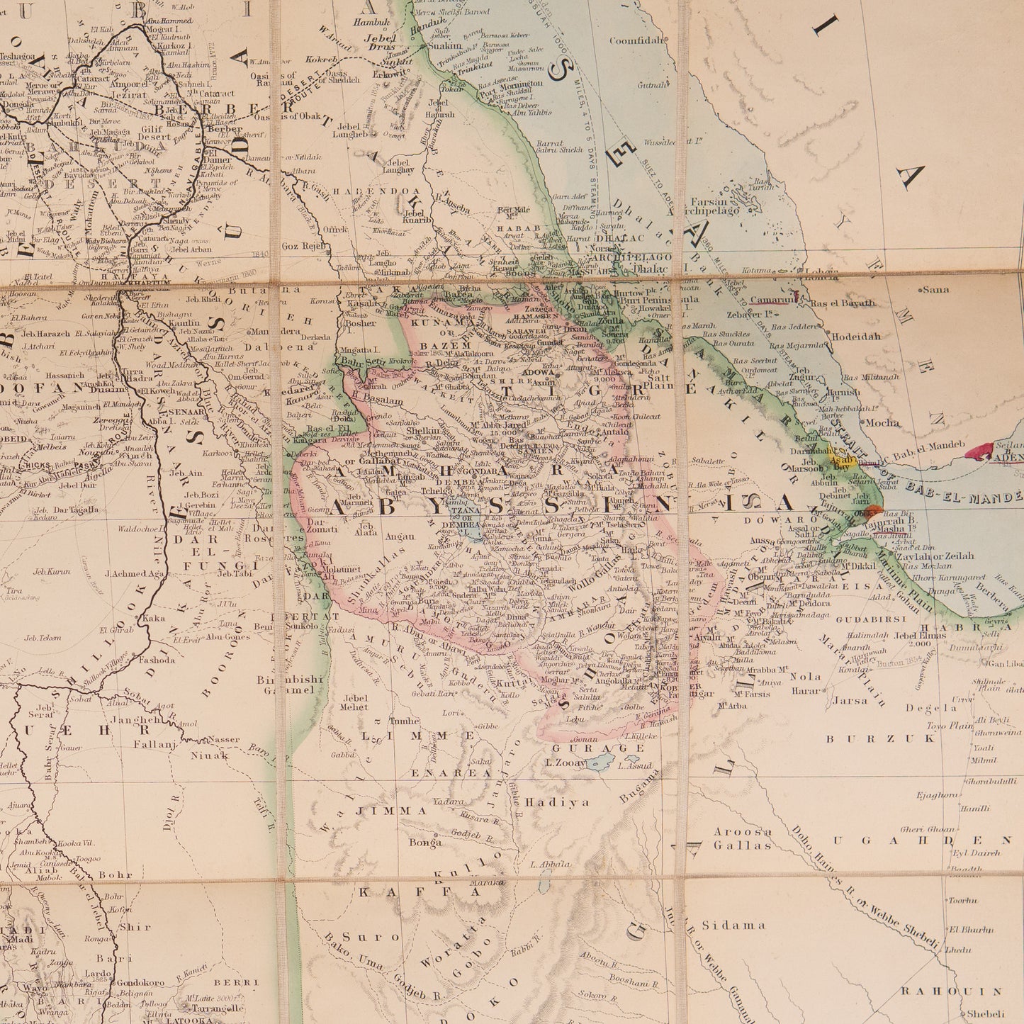
The map displays Northeast Africa including Egypt, the Red Sea and parts of the Arabian Peninsula and was published in the midst of colonial unrest to establish formal lines of demarkation.
Just a few years prior to publication, Britain formalized its presence in Egypt by supporting the established Pasha against a nationalist uprising that threatened his rule and stability in the region. Although still nominally an Ottoman protectorate, the British maintained forces along the Suez and exercised nearly unchecked political influence in the region. The threat of nationalism, however, didn't dissipate, and instead grew south of Egypt, in the Sudan (which was nominally a tributary region of Egypt). An Islamic uprising there had been threatening British influence with its protectorate since as early as 1881, and in 1884 Muslim forces besieged Khartoum, to the surprise of many. The city was still under siege at the time of publication and would hold out until early January of the following year, when it fell a mere two days before a relief force arrived.
The map itself can be seen as a part of the information war to maintain lines against Nationalist incursions and attempts at revision.
Unfolded, the linen-backed map measures approximately 22 x 26 inches.
Map of the Nile, from the Equatorial Lakes to the Mediterranean, Embracing the Egyptian, Sûdan (Kordofan, Dafur, &c. and Abyssinia. London. Edward Stanford. 1884
A good + copy, bound in cloth, generally solid, with generally bright pages.Some moderate rubbing to case. Very attractive.
Share